Form library · Health and safety

Excavation inspection checklist

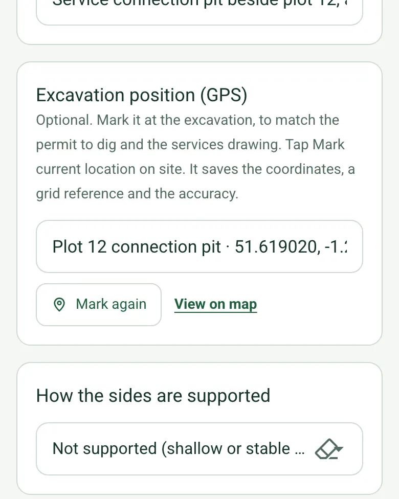
For people recording excavation inspections and follow-up. Record the scope, mark the excavation with GPS and say how the sides are supported. Measure the deepest point with a staff or from a photo, and the distance from the edge to the nearest spoil, materials or plant: the form compares it with the distance in your plan and goes red if it is closer. Record the observations, and the form counts them as acceptable, action needed or not checked. Then the report, the actions and the record status: the form counts open actions and flags a record marked ready for review while checks need action or actions are open. Try the form below, see every question or open a completed example.

Ready to use from the form library, and every question is yours to edit. Try it for a small trial fee, cancel any time.

Try it on your phone

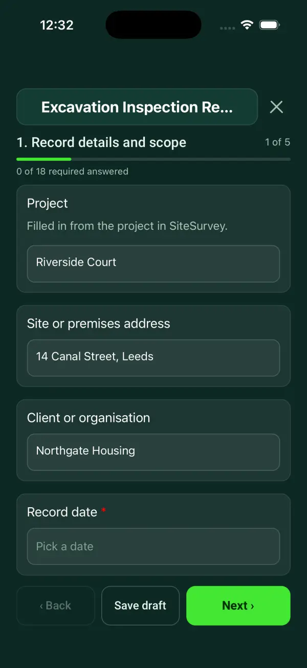
Try it on this phone

Fill in the excavation inspection report on your phone now

See how the excavation inspection report looks on your phone

Scan the code with your phone camera. It opens the real form, no sign-up needed.

Open the live example and fill it in, just as your team would on site. No sign-up needed.

See it on this phone

Every question is editable. Add this form to your account, then change the wording, add or remove questions and options, and make it fit your own jobs.

Or start your trial with this form ready →

One email, and we won't add you to a mailing list.

When should an excavation be inspected?

HSE describes competent inspections at the start of the working shift and after events that may affect strength or stability or a fall of earth or rock. CDM 2015 sets reporting duties for relevant inspections. Unsafe work must not continue while precautions are inadequate.

Last updated . Facts checked by the SiteSurvey team on 21 October 2026 against HSE excavation inspections and reports and CDM 2015 regulation 24 on inspection reports.

Built for excavation inspections

Mark the excavation with GPS, record how the sides are supported and measure the depth with a staff or from a photo. Enter the distance from the edge to the nearest spoil or plant and the distance in your plan, and the form goes red if it is closer. It counts the checks by result and flags a record marked ready for review while actions are open. It is an inspection record, not a support design or a permit to dig.

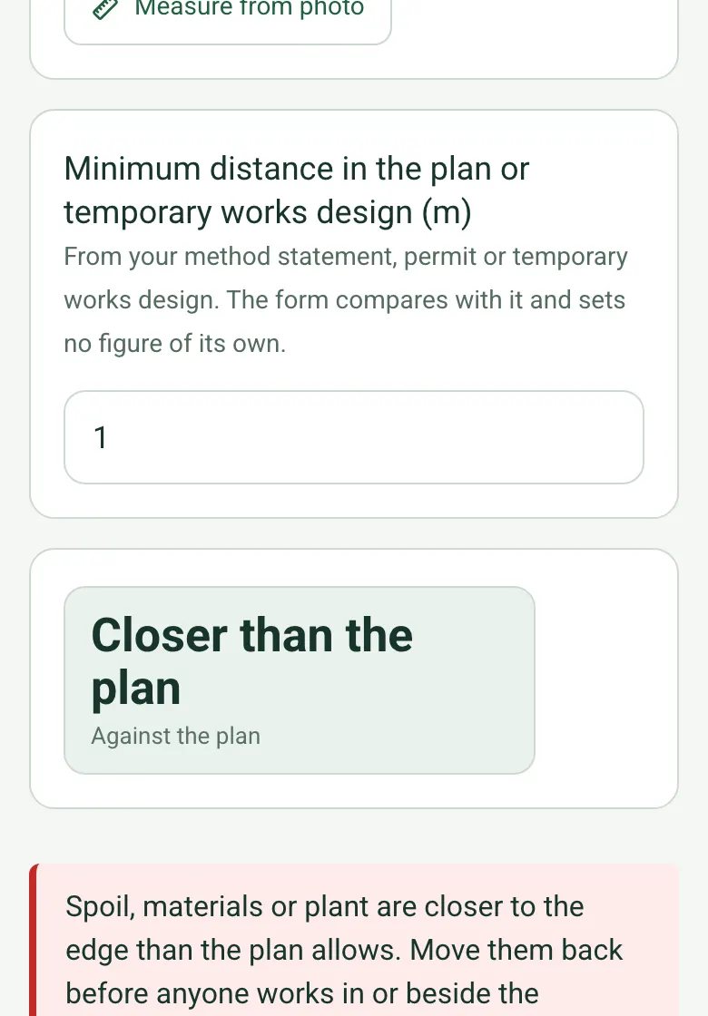
Nearest spoil to the edge 0.6 m, minimum distance in the plan 1 m, a tile reading Closer than the plan and a red note to move it back before anyone works in or beside the excavation

Spoil against the plan

Measure the distance from the edge to the nearest spoil, materials or plant, and enter the distance from your method statement or temporary works design. The form sets no figure of its own; if the spoil is closer, a red note says to move it back first.

How calculated fields work →
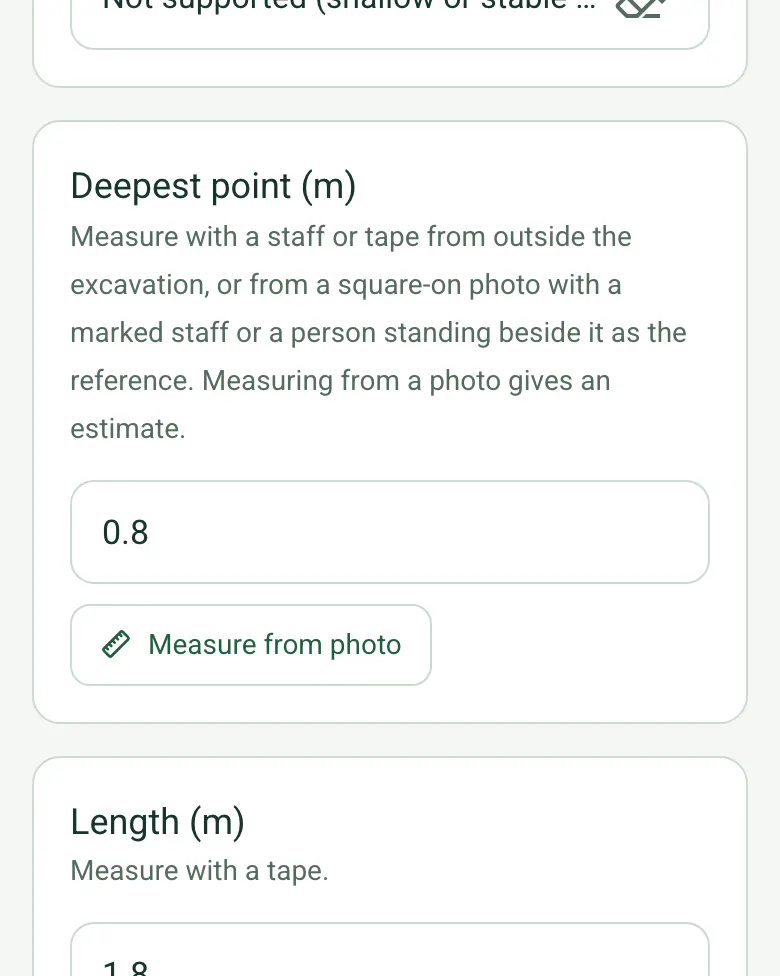
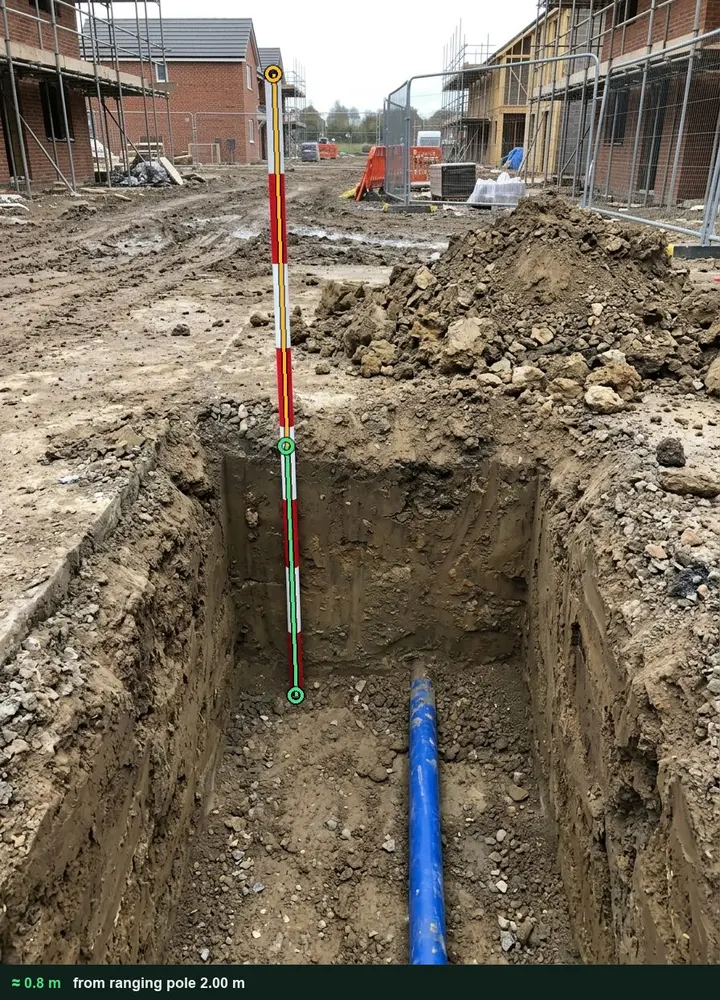
Deepest point 0.8 m with the Measure from photo button

Depth from a photo

Measure the depth with a staff from outside the excavation, or from a square-on photo with a marked ranging pole as the reference. It works on web forms in any phone browser today, and the app version is on its way.

How measuring from a photo works →
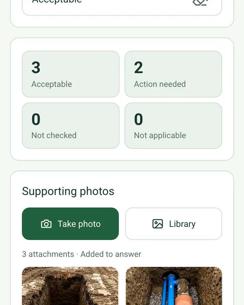
Tiles: 3 acceptable, 2 action needed, 0 not checked, 0 not applicable

Checks counted

The form counts the observations as acceptable, action needed, not checked and not applicable, and an amber note flags any check not done.

How calculated fields work →

Film the excavation

Add photos or a short video of the sides, the edge and the services, so the supervisor sees the excavation as it was.

A completed excavation inspection

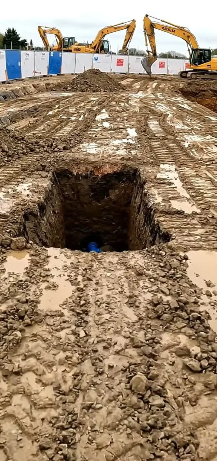
A fictional water connection pit on a housing site in Didcot: 0.8 m deep measured against a ranging pole, the spoil heap 0.6 m from the edge against 1 m in the plan, no barriers at the start of the shift. Both put right before work started; the record waits on the backfill.

An open service pit with a red and white ranging pole standing in it, marked up with the measured depth
Depth · about 0.8 m from the ranging pole
An open pit on a muddy site with no barriers round it and excavators behind
No edge protection at the start of the shift

Try the excavation inspection report form live

Answer a few questions and watch it adapt. Your answers are not saved, and any photos you add are deleted within the hour.

Live form: Excavation Inspection ReportOpen full screen ↗
Fill it in right here

This is the real form as your team would use it: questions appear as you answer, scores work themselves out and you can add photos and signatures. No sign-up needed. Or open a completed example to see every answer, photo and score filled in.

Want to see one filled in? See a completed excavation inspection report report (PDF), made by SiteSurvey from a fictional site visit.

Fill it in on a phone or tablet

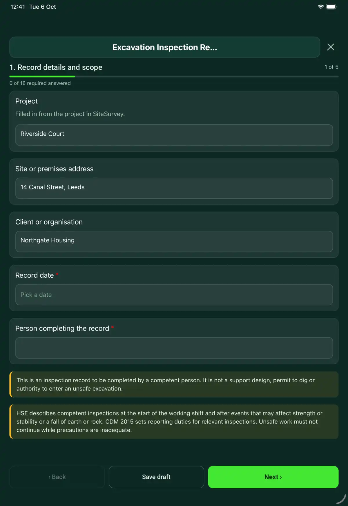
Your team completes the excavation inspection report on site in the SiteSurvey app on iPhone, iPad and Android phones and tablets. The project name and address fill in for them, it works without signal, and it syncs when the device is back online with photos kept against the question they answer.

Customers and subcontractors do not need the app: send them a link and they can fill it in from any browser.

The Excavation Inspection Report form in the SiteSurvey app on a tablet
The Excavation Inspection Report form in the SiteSurvey app on a phone

Every question in the excavation inspection report template

An excavation inspection record with scope, shift or event trigger, ground and support observations, hazards, actions and competent inspector details. 5 sections and 55 questions. Follow-up questions and guidance appear only when an answer calls for them, so the person on site never sees the ones that do not apply.

Make it your own: every question is editable

This is a starting point, not a fixed form. Once it is in your SiteSurvey account you can reword any question, add or remove questions, sections and answer options, and add your own logo, so it fits the way your team works and the jobs you do.

Details you only enter once

Add this form to a project in SiteSurvey and it fills in what the project already knows, so nobody on site retypes it and every form on the job uses the same names. Anything filled in can still be changed.

  • Project: the project name
  • Site or premises address: the site address, from the space or the project
  • Client or organisation: the project's customer

Record details and scope

  • ProjectShort answer

    Filled in from the project in SiteSurvey.

    Fills in from the project name
  • Site or premises addressShort answer
    Fills in from the site address, from the space or the project
  • Client or organisationShort answer
    Fills in from the project's customer
  • Record date*Date
  • Person completing the record*Short answer
  • Weather on siteAnswer
  • CheckThis is an inspection record to be completed by a competent person. It is not a support design, permit to dig or authority to enter an unsafe excavation.
  • CheckSources. The Construction (Design and Management) Regulations 2015 (CDM 2015). Regulation 22: excavations must be kept stable and inspected by a competent person at the start of each shift, after any event likely to affect their strength or stability, and after any accidental fall of rock, earth or other material; work must not continue until the matters found are put right. Regulation 23 covers cofferdams and caissons. Regulation 24: the person who carried out the inspection must prepare a report with the particulars in Schedule 7 before the end of the working period, give a copy within 24 hours to the person on whose behalf it was done, and the report must be kept on site until the work is complete and then for 3 months.

Inspection scope

  • Name and address of person the inspection is for*Short answer
  • Excavation location and description*Short answer
  • Excavation position (GPS)Short answer

    Optional. Mark it at the excavation, to match the permit to dig and the services drawing. Tap Mark current location on site. It saves the coordinates, a grid reference and the accuracy.

  • How the sides are supportedChoose one
    • Battered or stepped back
    • Trench box or drag box
    • Trench sheets and props
    • Hydraulic shoring
    • Not supported (shallow or stable ground, per the plan)
    • Other
  • Deepest point (m)Number

    Measure with a staff or tape from outside the excavation, or from a square-on photo with a marked staff or a person standing beside it as the reference. Measuring from a photo gives an estimate.

  • Length (m)Number

    Measure with a tape.

  • Width (m)Number

    Measure with a tape, or from a photo taken square on (an estimate). Do not enter the excavation to measure.

  • Nearest spoil, materials or plant to the edge (m)Number

    Measure with a tape, or from a photo with a barrier panel or a person in the same plane. Measuring from a photo gives an estimate.

  • Minimum distance in the plan or temporary works design (m)Number

    From your method statement, permit or temporary works design. The form compares with it and sets no figure of its own.

  • Against the planWorked out by the form
    Shown only when the answers above make it relevant
  • WarningSpoil, materials or plant are closer to the edge than the plan allows. Move them back before anyone works in or beside the excavation.
    Shown only when the answers above make it relevant
  • Date and time of inspection*Short answer
  • Inspection trigger*Choose one
    • Start of shift
    • After event affecting stability
    • After fall of earth or rock
    • Other
  • Inspector position and competence basis*Short answer
  • Support or battering design and permit referencesShort answer

Inspection observations

  • Support or battering and exposed ground condition checked*Choose one
    • Acceptable
    • Action needed
    • Not checked
    • Not applicable
  • Action, limitation or reason not applicable*Notes
    Shown only when the answers above make it relevant
  • Adjacent structures, loads and spoil position considered*Choose one
    • Acceptable
    • Action needed
    • Not checked
    • Not applicable
  • Action, limitation or reason not applicable*Notes
    Shown only when the answers above make it relevant
  • Safe access and edge protection in place*Choose one
    • Acceptable
    • Action needed
    • Not checked
    • Not applicable
  • Action, limitation or reason not applicable*Notes
    Shown only when the answers above make it relevant
  • Water, atmosphere and service risks addressed*Choose one
    • Acceptable
    • Action needed
    • Not checked
    • Not applicable
  • Action, limitation or reason not applicable*Notes
    Shown only when the answers above make it relevant
  • Changes since the previous inspection reviewed*Choose one
    • Acceptable
    • Action needed
    • Not checked
    • Not applicable
  • Action, limitation or reason not applicable*Notes
    Shown only when the answers above make it relevant
  • AcceptableWorked out by the form
  • Action neededWorked out by the form
  • Not checkedWorked out by the form
  • Not applicableWorked out by the form
  • WarningA check needs action. CDM 2015 regulation 22: work must not continue in or near the excavation until the matter is put right. Record what was done and tell the person in control of the work.
    Shown only when the answers above make it relevant
  • CheckA check was not done. Say why in its box, and do not let work start until it has been checked or the limitation is agreed.
    Shown only when the answers above make it relevant
  • Supporting photosPhotos

Report and action

  • Matters identified that could create risk*Notes

    Describe the observed condition, its exact location and the evidence. Record the response and communication in their separate fields.

  • Action taken immediately*Notes
  • Further action considered necessary*Notes
  • Person receiving the reportShort answer
  • Date and time report suppliedShort answer
  • Work restrictions and how they were communicatedNotes

Actions and review

  • Are further actions required?*Choose one
    • Yes
    • No
  • Further action
    Repeat for each further action. Each one asks:
    Shown when “Are further actions required?” is “Yes”
    • Action and evidence reference*Notes
    • PriorityChoose one
      • Urgent
      • High
      • Medium
      • Low
    • Person responsible*Short answer
    • Target dateDate
    • Action status*Choose one
      • Open
      • In progress
      • Completed
    • Completion evidence*Notes
      Shown when “Action status” is “Completed”
  • ActionsWorked out by the form
    Shown when “Are further actions required?” is “Yes”
  • Still openWorked out by the form
    Shown when “Are further actions required?” is “Yes”
  • Outstanding limitations and information to pass onNotes
  • Record status*Choose one
    • Ready for review
    • Further work needed
    • Work or use stopped
  • CheckChecks need action, or actions are still open, but the record is marked ready for review. Make sure the actions are done, or mark it as further work needed.
    Shown only when the answers above make it relevant
  • Reviewed byShort answer
  • Date reviewedDate
  • Author signature*Signature
  • CheckSigning records the information entered. It does not itself certify legal compliance, remove a limitation or authorise unsafe work.

Scope and responsibility

This is an inspection record to be completed by a competent person. It is not a support design, permit to dig or authority to enter an unsafe excavation.

What a useful entry looks like

Matters identified that could create risk

Describe the observed condition, its exact location and the evidence. Record the response and communication in their separate fields.

Water accumulation observed beside the north end of excavation E-03. Photograph E03-04 locates the observation for the responsible supervisor.

Fictional example of record wording. Use the actual evidence and approved arrangements for your job; this is not a completed report or an instruction to carry out the work.

See it filled in

A completed excavation inspection report report, made by SiteSurvey from a fictional site visit: every answer, the photos, the guidance that applied and the sign-off, ready to send as a PDF.

See completed form (PDF) ↗

Excavation Inspection Report FAQs

How should I record “Matters identified that could create risk”?

Describe the observed condition, its exact location and the evidence. Record the response and communication in their separate fields.

Does this replace a permit to dig?

No. The permit controls authorisation and precautions before work. This record captures inspection findings and actions for the excavation.

Who should complete it?

A competent person who understands the excavation hazards and precautions. Record their name, position and basis of competence.

What should a report include?

Record who it is for, the location, date and time, hazards, action already taken, further action and the inspector details. Confirm the applicable CDM reporting and retention requirements.

What are the limits of this template?

This is an inspection record to be completed by a competent person. It is not a support design, permit to dig or authority to enter an unsafe excavation.

Can I complete this form on site and share the record?

In the SiteSurvey app the form works offline, with photos and signatures recorded against the questions. Share the completed record as a PDF or a link. Dates and action owners are recorded fields; this form does not send reminders or update other systems.

Related

Hazards this form covers

Who each hazard harms, what the law expects and the control measures to look for, in our hazard library.

Related templates

Asbestos register and management plan template

An asbestos management record linking known or presumed materials to survey evidence, condition observations, controls, communication and review actions.

5 sections · 51 questions · See every question →
Temporary works register template

A temporary works register linking each item to its design brief, design checks, inspections, load or use releases, changes and dismantling authority.

5 sections · 45 questions · See every question →
Temporary works inspection checklist

A temporary works inspection linking the item, approved drawings, construction observations, changes, restrictions and separate release references.

5 sections · 51 questions · See every question →
Heavy equipment inspection checklist

A daily heavy equipment inspection for a mixed fleet of earthmoving machines, for the US and UK: each machine by work area with a data plate scan, the hour meter and hours to the next service, a machine type choice (excavator, wheel loader, backhoe loader, skid steer or compact track loader, dozer, dump truck or articulated hauler, roller, motor grader) that shows its own checks, eleven walk-round checks, eight cab and operation tests including the seat belt, horn, reverse alarm and brakes, the result for each machine (in service, restricted or tagged out), site checks, actions and sign-off.

4 sections · 191 questions · See every question →
RAMS template

One document for the job: hazards with suggested controls and 1 to 5 scores, the sequence of work with hold points, crew cards and competence, plant, COSHH, permits, emergency and rescue, briefing signatures and approval. Tailored to construction, electrical, AV and IT, roofing, facilities, events or grounds work.

8 sections · 151 questions · See every question →
Excavator daily checklist

An excavator pre-use record covering machine identity, attachment security, visibility, visible leaks, authorised function checks and defect restrictions.

6 sections · 48 questions · See every question →

Browse all 428 forms in the library

Use this excavation inspection report form with your team

Add it from the form library in one click, change any question, and every completed form becomes a branded PDF report.

Start your trial →