A survey of Japanese knotweed on a property. Walk round each stand and mark its outline with GPS, measure its length and width from a photo with a ranging pole or a door in line, and measure the distance to the nearest building the same way or with a tape. The form works out each stand's area, totals them, counts the stands and those at a boundary, and shows the nearest stand to a building. Then record the management proposed, with the GOV.UK rules shown for herbicide near water, burial and waste leaving the site. Try the form below, see every question or open a completed example.
✎Every question is editable. Add this form to your account, then change the wording, add or remove questions and options, and make it fit your own jobs.
Is it illegal to have Japanese knotweed on your property?
No. GOV.UK says you do not legally have to remove Japanese knotweed from your land unless it is causing a nuisance, but you must stop it spreading off your property, and you can be prosecuted for causing it to spread into the wild. Section 14 of the Wildlife and Countryside Act 1981 makes it an offence to plant or cause to grow in the wild any plant in Part II of Schedule 9, which lists Japanese knotweed. Contaminated soil or plant material may be controlled waste.
Walk the plot with the form on a phone. Mark the outline of each stand with GPS, measure its length and its distance to the nearest building from a photo with a door or a ranging pole in line, and the form works out each area, the total and the nearest stand. It records what was found and the management proposed; it does not set a RICS management category.
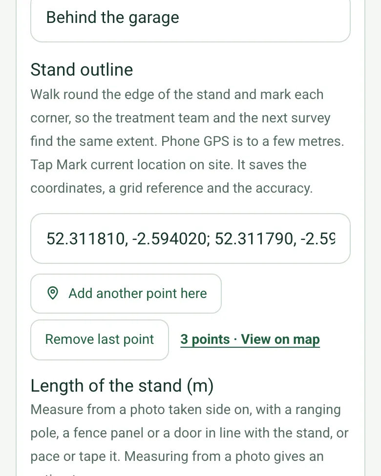
Mark the stand's outline
Walk round the edge of the stand and mark each corner, so the treatment team and the next survey find the same extent. Phone GPS is to a few metres. Mark current location works on web forms in any phone browser today, and the app version is on its way.
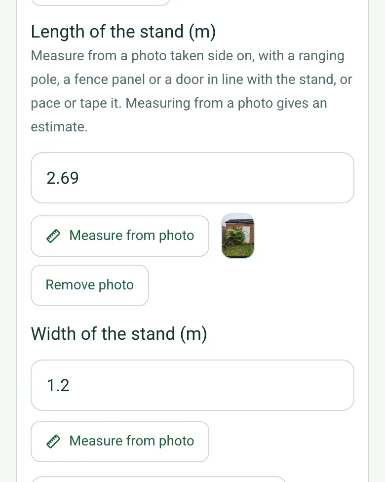
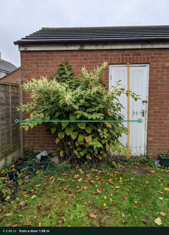
Take the photo side on with a door, a fence panel or a ranging pole in line with the stand, and measure its length. The form works out the area from the length and width, or takes a typed area for an irregular stand. It works on web forms in any phone browser today, and the app version is on its way.
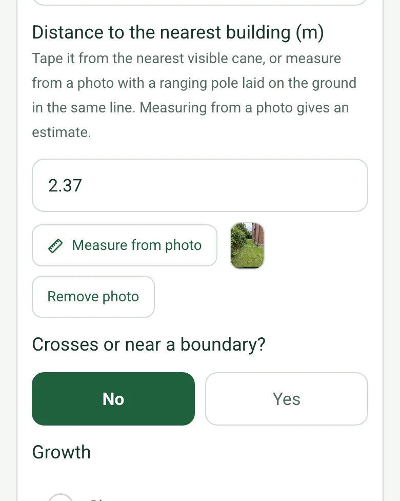
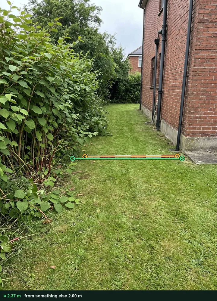
Lay a ranging pole on the ground between the stand and the wall and measure the gap from a photo, or tape it from the nearest visible cane. The rhizome can run further than the canes you can see.
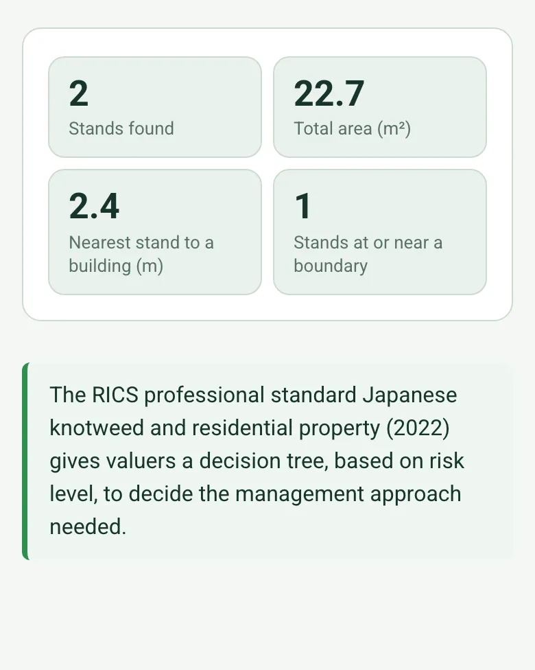
The form counts the stands, adds up the area, shows the nearest stand to a building and counts the stands at a boundary, ready for the management plan and the conversation with the neighbour.
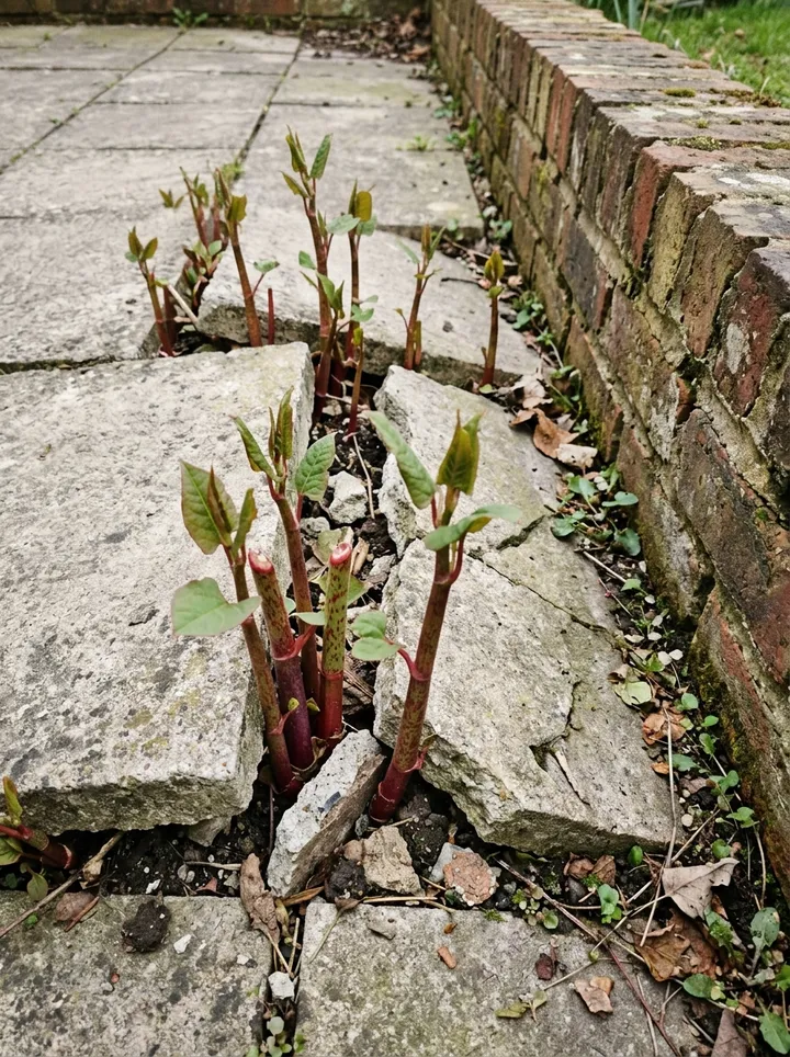
A fictional barn conversion: a flowering stand on the rear boundary by a stream, and a stand behind the garage measured at about 2.69 m long and 2.37 m from the house, coming up through the patio. Open it as a filled-in form, or switch to a blank copy and try it yourself.
This is the real form as your team would use it: questions appear as you answer, scores work themselves out and you can add photos and signatures. No sign-up needed. Or open a completed example to see every answer, photo and score filled in.
Every question in the japanese knotweed survey template
A Japanese knotweed survey: stands found with location, size, distance to buildings and boundaries, growth stage, damage, spread from or to neighbours, management plan and waste disposal. 3 sections and 46 questions. Follow-up questions and guidance appear only when an answer calls for them, so the person on site never sees the ones that do not apply.
✎
Make it your own: every question is editable
This is a starting point, not a fixed form. Once it is in your SiteSurvey account you can reword any question, add or remove questions, sections and answer options, and add your own logo, so it fits the way your team works and the jobs you do.
Details you only enter once
Add this form to a project in SiteSurvey and it fills in what the project already knows, so nobody on site retypes it and every form on the job uses the same names. Anything filled in can still be changed.
Project: the project name
Client: the project's customer
Site: the site, when the form is opened for a space or a product
Site address: the site address, from the space or the project
1
Survey
ProjectShort answer
Fills in from the project name
ClientShort answer
Fills in from the project's customer
Site*Short answer
Fills in from the site, when the form is opened for a space or a product
Site addressShort answer
Fills in from the site address, from the space or the project
Survey date*Date
Surveyor*Short answer
Weather on siteAnswer
SeasonChoose one
Spring
Summer
Autumn
Winter (dormant canes only)
CheckIn winter only dead canes show. Re-survey in the growing season to confirm the extent.
Shown when “Season” is “Winter (dormant canes only)”
GuidanceGOV.UK (England): you do not legally have to remove knotweed from your land unless it is causing a nuisance, but you must stop it spreading off your property, and you can be prosecuted for causing it to spread into the wild (section 14 of the Wildlife and Countryside Act 1981). Contaminated soil or plant material may be classified as controlled waste.
Walk Cam: site walk-aroundWalk Cam video with voice-to-text
Optional. Film a guided walk-through on the SiteSurvey app.
2
Stands
Was knotweed found?Yes or No
Stands
Repeat for each stand. Each one asks:
Shown when “Was knotweed found?” is Yes
Location*Short answer
Stand outlineShort answer
Walk round the edge of the stand and mark each corner, so the treatment team and the next survey find the same extent. Phone GPS is to a few metres. Tap Mark current location on site. It saves the coordinates, a grid reference and the accuracy.
Length of the stand (m)Number
Measure from a photo taken side on, with a ranging pole, a fence panel or a door in line with the stand, or pace or tape it. Measuring from a photo gives an estimate.
Width of the stand (m)Number
Area from the length and width (m²)Worked out by the form
Shown only when the answers above make it relevant
Area (m²), if the stand is not a rectangleNumber
Leave it blank to use the length x width above.
Distance, negativeWorked out by the form
Area used in the totalWorked out by the form
Distance to the nearest building (m)Number
Tape it from the nearest visible cane, or measure from a photo with a ranging pole laid on the ground in the same line. Measuring from a photo gives an estimate.
Crosses or near a boundary?Yes or No
Distance to the nearest boundary (m)Number
Measuring from a photo gives an estimate. Use a tape or laser where the figure matters.
s_neg_boundaryWorked out by the form
GrowthChoose one
Shoots
Full canes
Flowering
Dead canes
Damage seen (paving, walls, drains)Short answer
Photos (with a scale)Photos
Stands foundWorked out by the form
Shown when “Was knotweed found?” is Yes
Total area (m²)Worked out by the form
Shown when “Was knotweed found?” is Yes
Nearest stand to a building (m)Worked out by the form
Shown only when the answers above make it relevant
Stands at or near a boundaryWorked out by the form
Shown when “Was knotweed found?” is Yes
Nearest stand to a boundary (m)Worked out by the form
Shown only when the answers above make it relevant
GuidanceThe RICS professional standard Japanese knotweed and residential property (2022) gives valuers a decision tree, based on risk level, to decide the management approach needed.
3
Management
Management proposedChoose one
Herbicide treatment programme
Excavation and removal
Excavation and on-site burial
Monitor only
None needed
Is any stand near a river, stream or pond?Yes or No
Shown when “Was knotweed found?” is Yes
CheckGOV.UK: get agreement from the Environment Agency before using herbicide on knotweed near water.
Shown when “Is any stand near a river, stream or pond?” is Yes and “Management proposed” is “Herbicide treatment programme”
CheckGOV.UK: tell the Environment Agency at least one month before burying knotweed. Bury it on the site it came from, at least 5 metres deep, or at least 2 metres deep if sealed in a geotextile membrane.
Shown only when the answers above make it relevant
Will contaminated soil or plant material leave the site?Yes or No
CheckGOV.UK: use a registered waste carrier and a disposal site with the right permit, tell the site in advance, and cover or enclose the load. A business moving waste needs a waste transfer note for each load and must keep a copy for 2 years.
Shown when “Will contaminated soil or plant material leave the site?” is Yes
Notes and guarantee termsNotes
Actions (treatment, notifications, follow-up)
Repeat for each action. Each one asks:
Action needed*Notes
PriorityChoose one
Urgent
High
Medium
Low
Who will do itShort answer
Due byDate
StatusChoose one
Open
In progress
Completed
PhotosPhotos
Next visit or re-survey dueDate
Set by the surveyor. Treatment visits and re-surveys are best done in the growing season, when the plant shows its full extent.
Days to the next visitWorked out by the form
Shown when “Survey date” is answered and “Next visit or re-survey due” is answered
CheckThe next visit date is before the survey date. Check the date.
Shown only when the answers above make it relevant
Client nameShort answer
Client signatureSignature
Completed byWorked out by the form
Surveyor signatureSignature
See it filled in
A completed japanese knotweed survey report, made by SiteSurvey from a fictional site visit: every answer, the photos, the guidance that applied and the sign-off, ready to send as a PDF.
The RICS professional standard Japanese knotweed and residential property (2022) gives valuers a decision tree, based on risk level, to decide the management approach needed.
Can it be surveyed in winter?
Only dead canes show in winter. Re-survey in the growing season to confirm the extent. The form warns when the survey is in winter.
What about waste?
GOV.UK says to use a registered waste carrier and a disposal site with the right permit, and to cover or enclose the load. A business moving waste needs a waste transfer note for each load and must keep a copy for 2 years.
Can it be buried on site?
GOV.UK says to tell the Environment Agency at least one month before burying knotweed, and to bury it on the site it came from at least 5 metres deep, or at least 2 metres deep if sealed in a geotextile membrane.
What about knotweed near water?
GOV.UK says to get agreement from the Environment Agency before using herbicide near water, and that treatment usually takes at least 3 years. The form asks whether any stand is near water.
Who uses this?
Invasive weed specialists, surveyors, landlords, housing associations and homeowners selling a property.