Space map Web dashboard
A plan per floor.A pin per space.
Upload the floor plan and pin every project space where it sits. Click a pin to open the space, with its forms, photos, products and status. Pin colours turn the plan into a progress board.
PlanIncluded on Base and The Works, from £13 per user per month. Trial from £1.
How does the space map work?
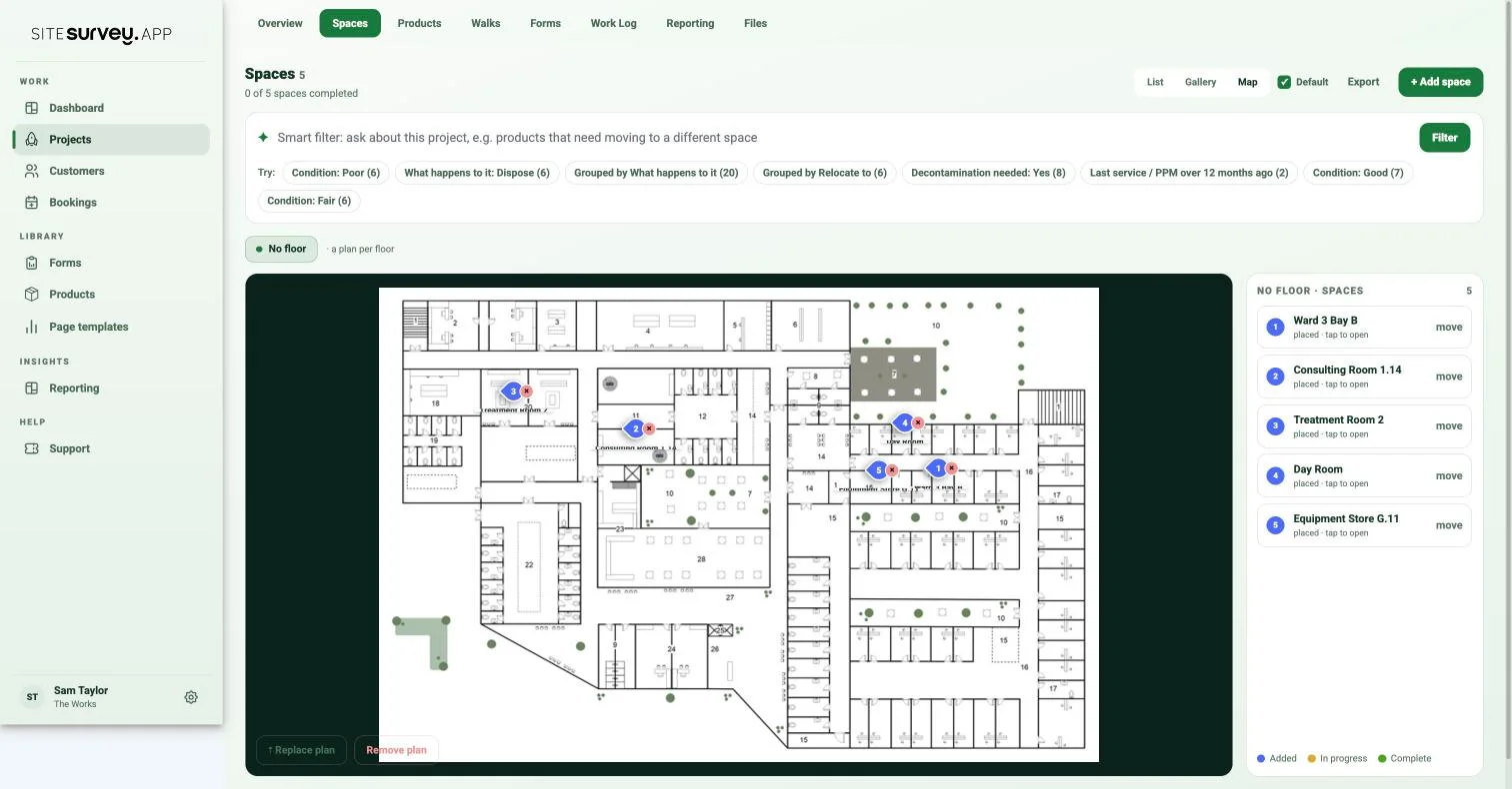
Open a project's Spaces tab on the web dashboard and choose Map. Upload a PNG or JPG plan for the floor, then pick a space from the list and click the plan where it sits. The pin lands on that point, numbered and named, in the colour of the space's status. Click any pin to open the space with its forms, photos, products and sign-off. Each floor has its own plan, and replacing a plan keeps the pins.
Last updated 25 October 2026.
01 · Try it
Pick a space, click the plan. It is placed.
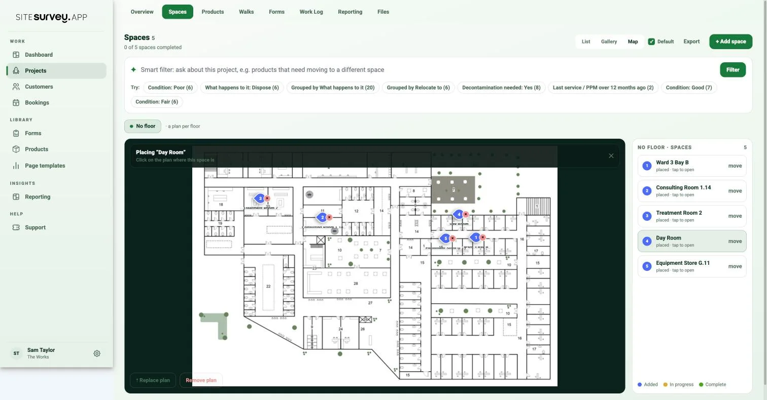
The same steps as the Map view in the dashboard. Day Room is waiting: click the plan where it is. Then click any pin to open the space and change its status.
Ground floor · spaces
Example plan and spaces. Nothing is saved.
02 · How it works
The project, laid out on the drawing.
A list of twenty spaces tells you what was surveyed. The same twenty pinned to the plan tell you where, what is next door, and which end of the floor is finished.
- One plan per floor. Floor tabs come from the floors your spaces are on. Spaces with no floor share a plan of their own. PNG or JPG up to 40MB (a PDF is stored, but pins go on image plans).
- Pins land where you click. Numbered and captioned with the space name. Move one from the list, or remove it from the pin.
- Status at a glance. Blue for added, amber for in progress, green for complete.
- New revision, same pins. Replace the plan and every pin stays where it was.
- Pinned badge. Gallery and List views show which spaces are on the plan. Any of the three views can be the default.
03 · Open a space
Every pin is a door into the room.
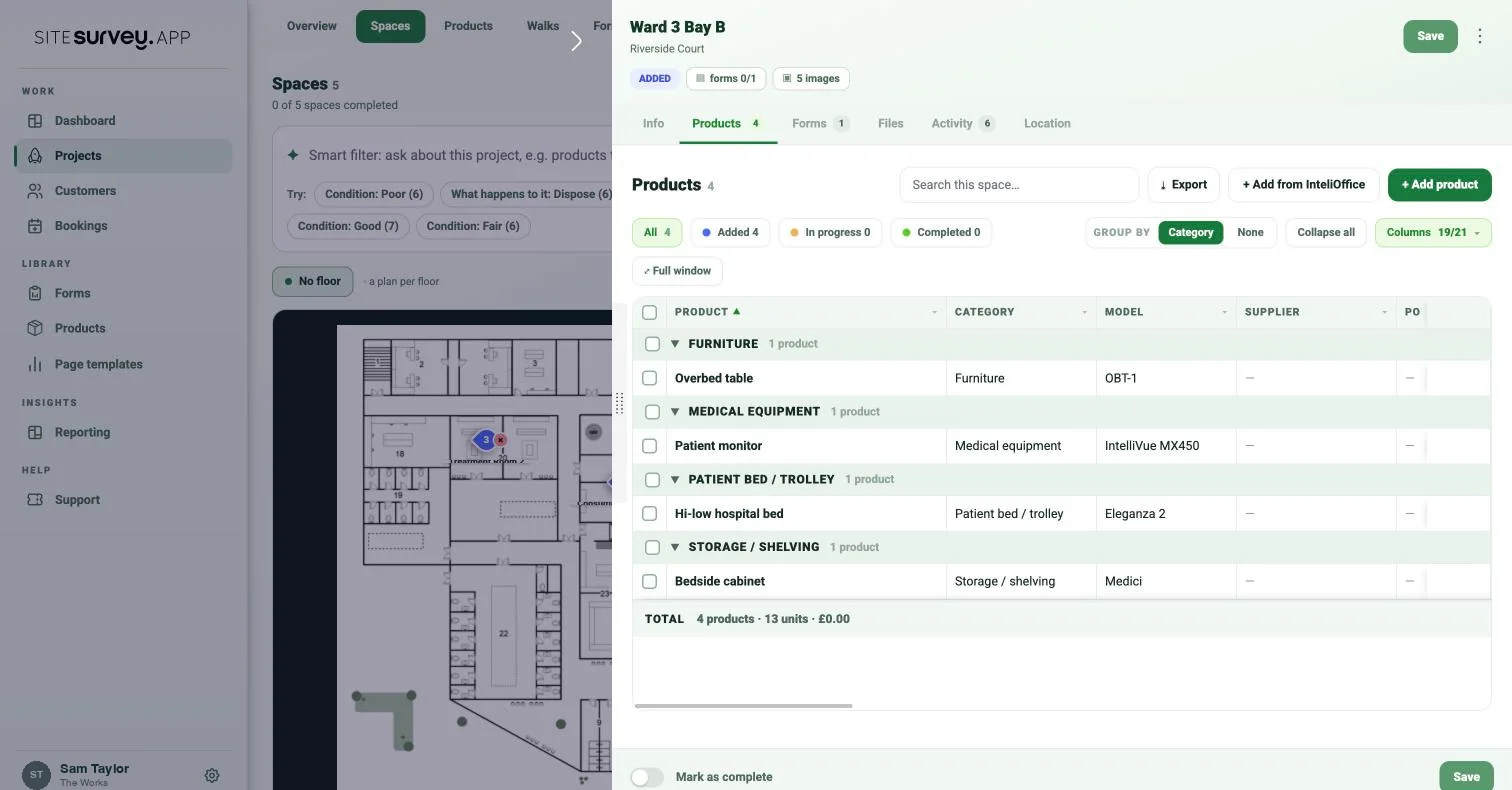
Click a pin or its caption and the space opens beside the plan: its details, the products installed there with make and model, its forms, files and activity. Mark it complete from the same drawer and the pin turns green.
- Info, Products, Forms, Files, Activity, Location. One click from the plan.
- Captured on site, seen in the office. Spaces and their data come from the mobile app or the web.
- Works in light and dark appearance.
04 · Which do I need?
Have a drawing? Pin it. No drawing? Walk it.
Both live on the same Map tab. If a floor was captured with the app, the App capture toggle shows that plan with zoom, pan and dimensions, and downloads it as PNG or PDF.
| Upload a plan (this page) | AR capture | |
|---|---|---|
| Best when | You already have an accurate drawing | There is no drawing, or it is out of date |
| Where | In the web dashboard | On site, on an iPhone |
| You get | Your drawing, with existing spaces pinned on it | A measured plan, with a space created for every room |
| File | PNG or JPG up to 40MB (a PDF is stored, but pins go on image plans) | Downloads as PNG or PDF |
SiteSurvey Space Map, at a glance
- What it is
- The Map view of a project's Spaces tab: an uploaded plan per floor with a pin for every space.
- Who uses it
- Office and project teams who need to see a survey, install or inspection laid out on the floor plan.
- Plans
- PNG or JPG up to 40MB (a PDF is stored, but pins go on image plans), one per floor. Replace a plan and the pins stay. Plans captured with the app show on the same tab.
- Pins
- Placed by clicking the plan; numbered, captioned with the space name, coloured by status; click to open the space.
- Where
- Web dashboard. Spaces and the data behind each pin are captured in the mobile app or on the web.
- Plan
- Included on Base and The Works, from £13 per user per month. Trial from £1, cancel any time.
What is the space map?
The space map is the Map view of a project's Spaces tab in the web dashboard. You upload a plan for each floor, then pin every project space to the place it sits on the drawing. Each pin opens the space, with the forms, photos, products and status recorded there, so the project reads as a plan rather than a list.
What kind of plan can I upload?
A PNG or JPG image of the floor plan, up to 40MB. An architect's PDF can be stored, but pins are placed on image plans, so export the page you need as a PNG or JPG first. If you have no drawing, walk the rooms with the mobile app and SiteSurvey draws the plan for you: see the floor plans feature.
How do I place a pin?
Open the Map view, choose the floor, then pick a space in the list on the right and click the plan where that space is. The pin lands on the point you clicked, numbered and captioned with the space name. Use move to reposition it, or remove it from the pin itself.
Can I have more than one floor?
Yes. Each floor that has spaces gets its own tab and its own plan. Spaces are grouped by the floor they belong to, so the Ground Floor plan only lists ground floor spaces.
What happens if I replace the plan?
The pins stay. Positions are stored as a proportion of the plan, so a new revision of the drawing at a different size keeps every pin where it was. Use Replace plan for a new revision and Remove plan to start again.
What do the pin colours mean?
The pin takes the status of its space: blue for added, amber for in progress and green for complete. The map doubles as a progress view of the floor.
Does the map show in the Gallery and List views?
Pinned spaces show a Pinned badge in the Gallery and List views, and the Map view can be set as the default view for the Spaces tab. Any of the three views can be the default.
Is this the same as the AR floor plan?
They share the same Map tab. The space map is for a drawing you already have: upload it and pin the spaces. The AR floor plan is captured on site with the phone, and every room captured becomes a space on the plan automatically. A floor can show either, and you can switch between an uploaded plan and the app capture.
See it on your next project